Project Overview
Shared-use paths and trails play a critical role in supporting the region’s transportation and recreational facilities. They function as the interstates of the bicycle and pedestrian network, enhancing mobility while providing access to jobs, businesses, parks, and more. They are also expensive to maintain and are not supported by federal and state funding programs. As a result, local jurisdictions must be strategic when conducting maintenance activities.
To address these factors and concerns, R1 is developing its first-ever State of the Trails Report. This report will provide local jurisdictions with the data they need to develop targeted maintenance plans. By leveraging this data, they can ensure that the region's paths and trails continue to service communities, supporting mobility and recreational access for years to come!
In addition to being shared publically and with local jurisdictions, the report will also inform R1's 2026 Greenways Plan. It will allow the Greenways plan to expand its scope and provide a more comprehensive assessment of current conditions in the region, leading to more informed strategies and recommendation for improving the region's greenways network. For more information on the 2026 Greenways Plan, click here.
Shared-Use Paths: Connecting People and Places
A shared-use path is a path designed for multi-modal use, accommodating pedestrians, cyclists, and other non-motorized modes of transportation. Shared-use paths are often paved for easy access, have clear markings and signage, and are typically found alongside roads or in urban areas.

Bike Walk Kentucky | Image Source
Trails: Exploring Nature and Adventure
A trail on the other hand, is primarily designed for hiking or cycling in natural or rural areas. Trails may be used for more specific recreational activities like mountain biking or hiking and often have more varied terrain.

Sonoma County Regional Parks | Image Source
Data Collection
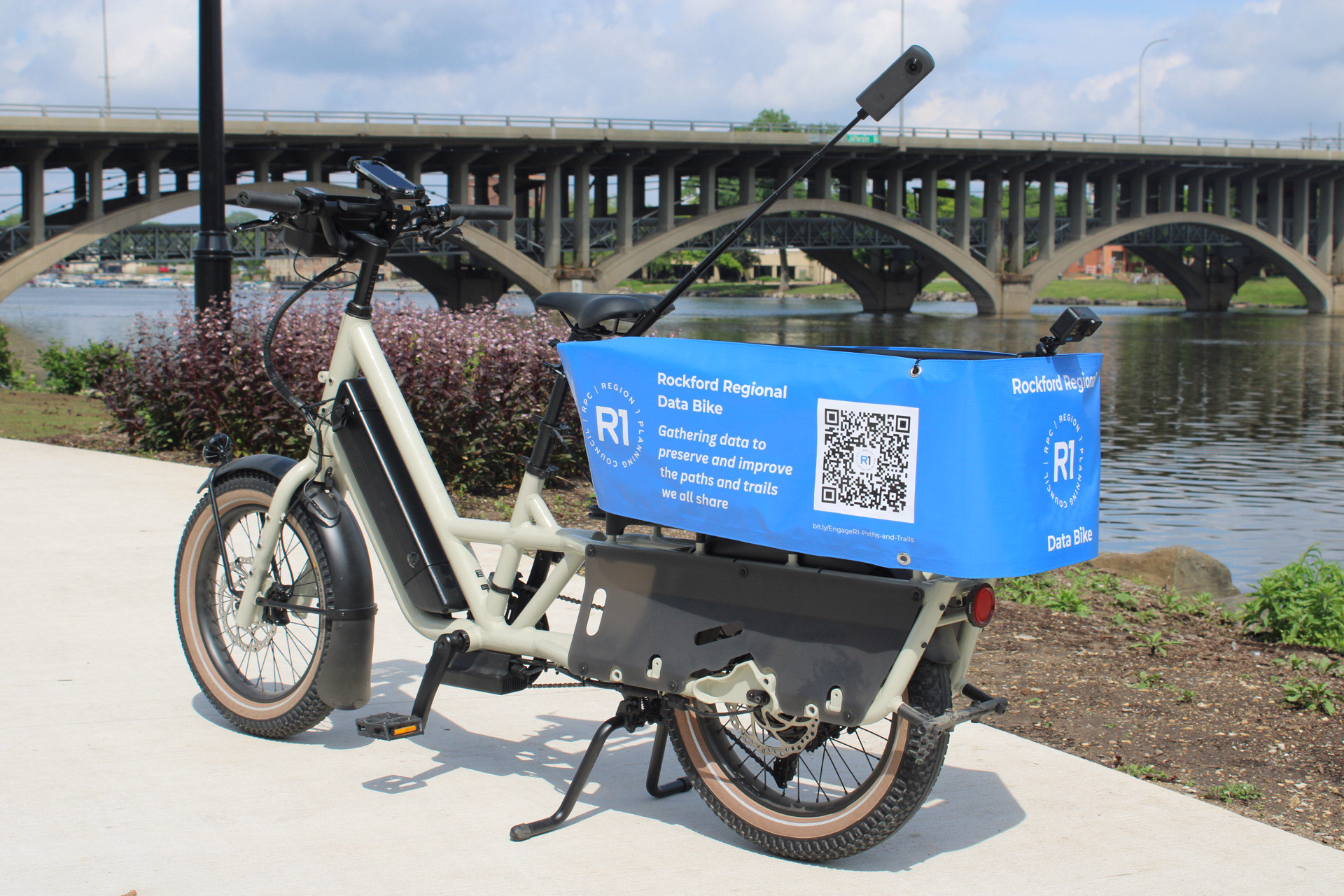
To support this goal, R1 is building a data bike, equipped with cameras and sensors. R1 staff will travel around the regions' shared use paths and trails on the data bike, collecting several valuable pieces of data that will be used to improve bicycle infrastructure in the Rockford Region. The data points to be collected during the assessment are listed below.
R1 will work with local jurisdictions to confirm the location of all existing shared-use paths and trails in the region. This information will support the creation of a new regional bicycle map, which will be shared with the public digitally and physically.
An iPhone mounted on the data bike will operate an app called SensorLog, which utilizes the iPhone’s internal scales and gyros to detect the roughness of the pavement. This data will inform condition ratings for path and trail segments, which can be used to prioritize maintenance.
 A GoPro mounted on the rear of the data bike will take georeferenced photos of the pavement every two seconds. This imagery will be used by local jurisdictions to assess pavement condition remotely, and plan the appropriate treatment.
 A Ricoh Theta X will take 360-degree images that will be uploaded to Google StreetView. This imagery will fully illustrate path and trail conditions, and can help the public plan bicycle and pedestrian trips.

Tube counters will be laid across the ground on various paths and trails to capture the numbers of users at each facility. This data will further help with maintenance prioritization.
An iPhone operating ArcGIS Field Maps will be used to inventory all amenities along the region's paths and trails, such as benches and water fountains.
Impairments to users not captured by SensorLog, such as overhanging tree limbs, will also be captured on the iPhone operating ArcGIS Field Maps.
All of the data collected during the assessment will be used to create a report detailing the condition and user experience of each shared-use path and trail in the Rockford Region. The data will be presented at both the system level and path and trail level.
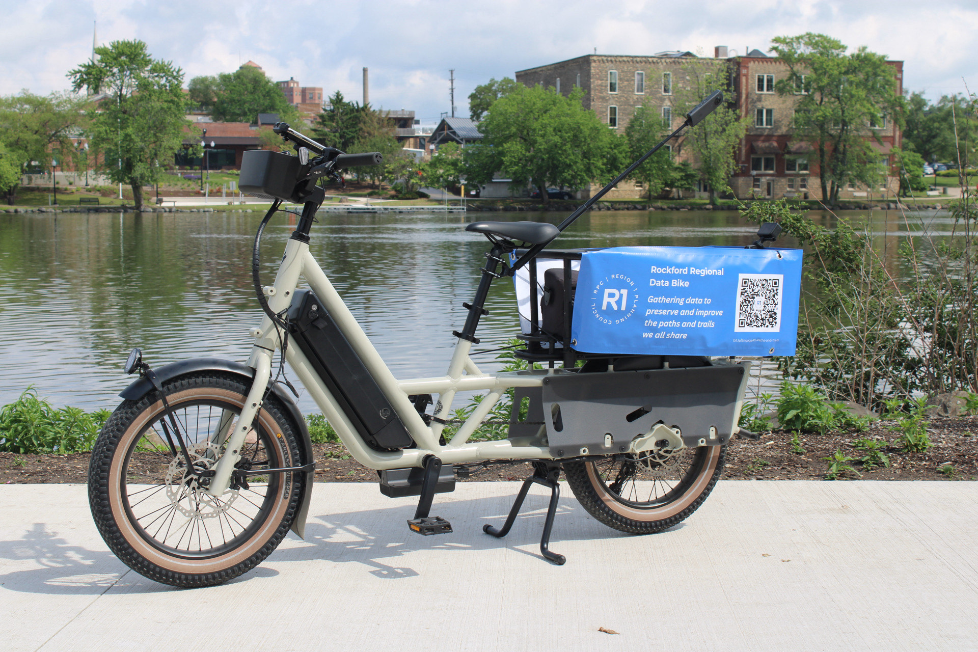
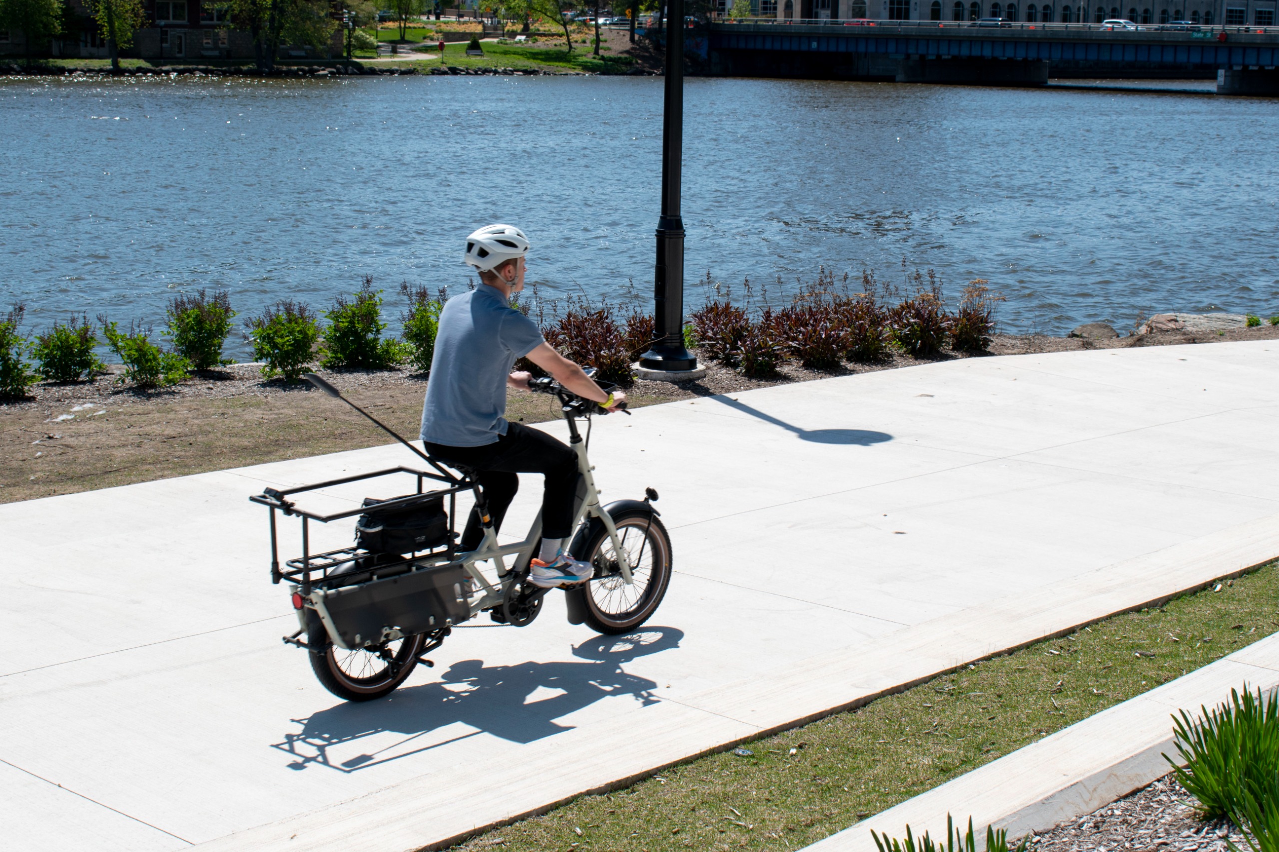
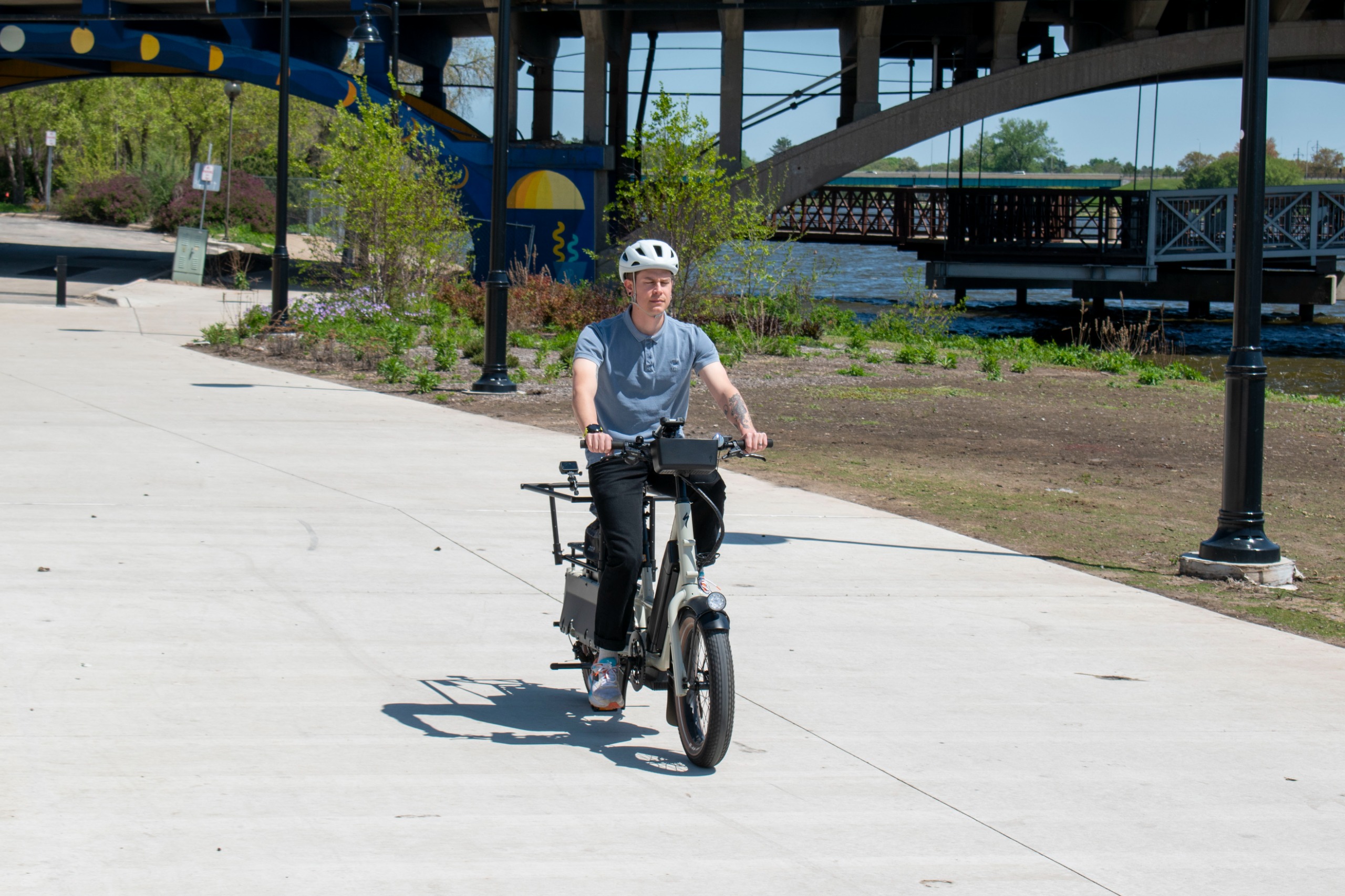
Data Bike
R1 has built the Rockford Regional Data Bike, equipped with cameras and sensors. R1 staff are travelling around the region's shared-use paths and trails on the data bike, collecting several valuable pieces of data that will be used to improve bicycle infrastructure in the Rockford Region. R1 owns the data bicycle and all of its components, and intends to use it to repeat the assessment in future years.
Image 1 of 4
Regional Paths & Trails Map
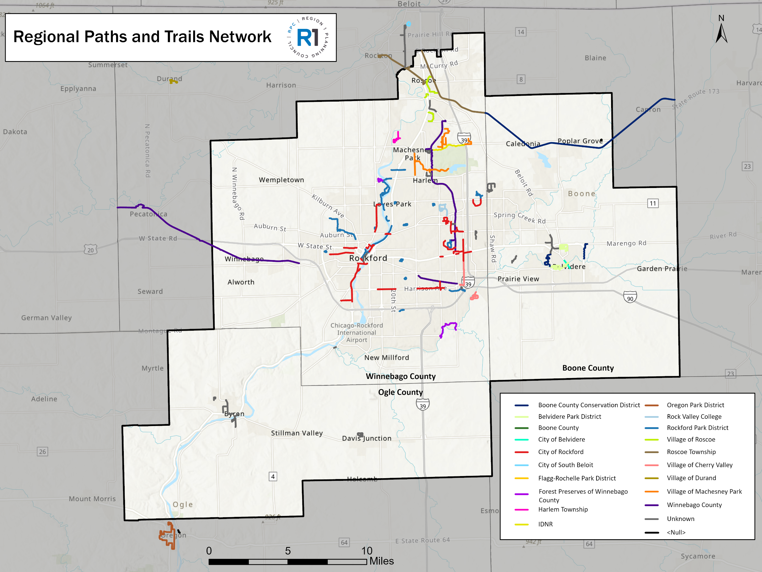
Rockford Region Paths & Trails Network (2025)


