Project Overview
As climate change and extreme weather in the region intensify, there is an increased urgency to be proactive in hazard mitigation and adaptation planning. The region will see increased frequency and intensity of natural disasters, such as flooding, extreme weather, and storms, that will affect the transportation network and those who use it.
The Resilience Improvement Plan (RIP) identifies areas within the transportation network most vulnerable to hazards, supporting a resilient and reliable transportation infrastructure. The RIP promotes surface transportation resilience to natural and infrastructure hazards through a hazard risk assessment, identifying infrastructure priorities, developing strategies for system improvements, and supporting community quality of life.
Events in the Region
Natural and infrastructure-related hazards are not distant threats—they are happening now and increasingly affecting our communities. These events disrupt daily life, damage essential systems, and highlight the urgent need for resilient planning and preparedness.
Natural Hazards

The Rockford Region experiences a wide range of weather conditions throughout the year. When severe, these events become natural hazards that can disrupt transportation, impact the local economy, and pose risks to public health and safety.
Below are the top natural hazards affecting our transportation system, ranked by importance based on feedback from community members and stakeholders.
A winter storm takes the form of heavy snow, blowing snow, and dangerous wind chills.
An ice storm is caused by sleet or freezing rain, resulting in the accumulation of at least 1/4 of an inch of ice on exposed surfaces.
Impacts on the Transportation System
- Transportation disruptions due to debris and/or slick driving conditions
- Flight cancellations
- Road closures
- Delays in public transportation services
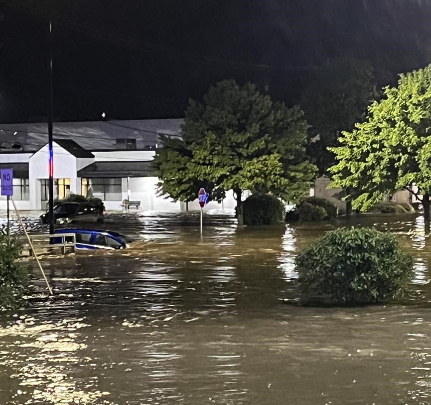
Flooding occurs when water levels rise in existing waterways, such as rivers, streams, or drainage ditches. The water level rise will lead to the inundation of dry areas. There are 2 types of flooding in the Rockford Region:
Riverine Flooding - rivers or streams exceed the capacity of their channels to accommodate water flow, overflowing into normally dry land.[i]
Flash Flooding - caused by heavy or excessive rainfall over a short period, typically less than 6 hours.
Impacts on the Transportation System
- Flooding increases the likelihood of vehicle crashes, delays, and traffic.
- Route closures affecting roadways, freight transportation, and emergency services
- Route disruptions for pedestrians, cyclists, and public transit
Severe thunderstorms have one or more of the following characteristics: strong winds, large and damaging hail, and frequent lightning.
During the development of a thunderstorm, tornadoes can form. Tornadoes are formed from a change in wind direction and an increase in wind speed.
Impact on the Transportation System
- Thunderstorms and its byproducts can severely damage infrastructure
- Cause damage to powerlines
- Hail can cause damage to aircraft, homes, and cars
- Severely disrupt the commute and path of pedestrians and cyclists.
Extreme heat events for a region are defined as temperatures over 10°F above the average temperature for several days to weeks.
Similarly, extreme cold is an unusually low temperature for an extended period of time. Extreme cold events can be accompanied by blizzards, ice storms, and strong winds.
Impacts on the Transportation System
Extreme Heat
- Can cause surface roads to deform and rail lines to buckle
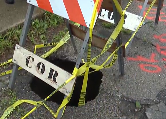
- Induce drought and cause sinkholes, affecting roads, buildings, and water pipes
Extreme Cold
- Freezing, icy, and snowy conditions can lead to dangerous road and rail conditions
A drought is a period of well-below-average precipitation that spans from a few months to a few years. During a period of drought, the soil moisture does not meet regional needs, directly impacting agricultural and water systems.
Agricultural drought refers to a period when soil moisture is inadequate to meet the demands for crops to initiate and sustain plant growth.
Hydrological drought is a period of below-average streamflow and depleted reservoir storage.
Impact on the Transportation System:
- Farmers rely on the regional transportation network to move products to markets in and out of state.
- Soil shrink-swell cycles can damage:
- Roadbeds and pavement, leading to cracking and surface failures.
- Underground utilities and pipelines near or beneath transportation corridors.
- Repeated damage increases maintenance costs and disrupts traffic flow.
A wildfire is an unplanned wildland fire, including unauthorized human-caused fires, escaped wildland fire use events, and escaped prescribed fire projects.[i] Wildfires can start naturally or be caused by human activities such as campfires, fireworks, or power lines. Wildfires can vary in size and severity.
Impacts on the Transportation System
- Can result in road closures, severely impacting rural areas
- Loss of vegetation can lead to soil erosion
- Burned areas are more likely to be susceptible to flooding
- Smoke form wildfires can lead to poor visibility
A landslide is a term used to describe the movement of soil, rock, and organic materials down a slope under the effects of gravity and also the landform that results from such movement.[i]
Impacts on the Transportation System
- Can cause network blockages, delays, damage, and closures
- Can damage roads, bridges, railways, and other crucial infrastructure
Earthquakes are caused by a sudden slip on a fault, which is a fracture in the Earth’s crust where movement has occurred in the past.[i] When a slip occurs, energy is released and travels through Earth’s crust, causing the shaking that is felt during an earthquake.
Impacts on the Transportation System
- Can cause the collapse of buildings and infrastructure, disrupt utilities, trigger landslides and avalanches
- Bridges, roadways, and rail can all be impacted or damaged by earthquakes
Infrastructure Hazards

Infrastructure systems in the Rockford Region are vulnerable to failures caused by aging infrastructure, human error, and evolving technology. When the reliability and safety of the system are compromised, the impacts are especially severe on the transportation network, creating infrastructure hazards. These hazards pose risks to transportation infrastructure and systems, including emergency response capabilities, evacuation routes, economic stability, and community health.
The following are the identified infrastructure hazards, listed in order of importance as determined by you and our stakeholders.
Grid disruptions or electrical and communications disruptions occur when damage to power lines causes a disconnect in the distribution of electricity between the power system and homes, businesses, and transportation infrastructure. This can be a transmission line disruption or an electrical outage.
Impacts on the Transportation System
- Shutdown of traffic lights, signaling systems
- Communication, security, and systems management can affect airports and bus, and rail stations
- Disrupt communication networks, emergency services, and traffic management systems
- Traffic congestion
- increased risk of accidents
- delayed emergency responses
- Airports can encounter flight delays and cancellations
- EV charging issues
A water main is an underground pipe that transports water to a home's service pipe, typically located beneath streets and sidewalks. When a water main breaks occurs water escapes to the surface due to a crack or hole in the pipe.
Similarly, a gas break occurs when an underground pipeline transporting natural gas fractures or ruptures and releases gas.
Impacts on the Transportation System
- Damage to roadways, flooding in streets, and road closures
- Pedestrian safety is compromised due to pavement conditions
- Can require large-scale evacuations and repairs, causing delays and rerouting affecting pedestrians, cyclists, buses, and vehicles
Structural failures refer to the collapse or malfunction of bridges, buildings, and other essential structures, making them unable ot function as intended.
Structural failures can result from both human actions and natural events. This includes issues such as design defects, construction mistakes, and design flaws, as well as environmental factors like earthquakes or floods.
Impact on the Transportation System
- Traffic flow disruptions and increased travel times due to detours and rerouting vehicles
- Heavy traffic on detour routes can be hazardous, as these roads may not be designed to handle large volumes of vehicles or heavy trucks.
Cyber-attacks refer to intentional attempts by individuals or groups to infiltrate the information systems of an organization or infrastructure with the goal of theft, disruption, or damage.
These attacks can take various forms, such as malware, phishing, ransomware, or unauthorized access to sensitive networks.
Impacts on the Transportation System
- Potentially disrupts or shuts down entire systems and services, including booking platforms (such as airlines and railways)
- Comprises sensitive data
- Significantly impact supply chains in healthcare, agriculture, mining, and trade
- Can be linked to electrical grid failures, impacting internal networks and transportation systems
Chemical, biological, radiological, and nuclear (CBRN) materials are hazardous substances that can pose serious risks to health, safety, and the environment, especially when released during transport or storage.
Accidental releases or leaks of these substances can occur at sites like nuclear plants, hospitals, or during vehicle transport, including fuel spills.
Impacts on the Transportation System
- Traffic flow interruptions on affected routes, with potential delays
- Airport incidents (e.g., jet fuel spills) can block nearby roads and delay flights
- Facility accidents may lead to evacuations and overcrowding of evacuation routes
- Increased strain on emergency response and transportation infrastructure during incidents
A dam is a barrier constructed across a waterway to store, control, or divert water.[i] Dam failure refers to structural collapse, breach, or other failure that causes downstream flooding.
A levee is a man-made structure, usually an earthen embankment, constructed to contain, control, or divert the flow of water to reduce the risk of temporary flooding.[ii]Levee failure or overtopping typically occurs during larger flood events. Levees also deteriorate over time, requiring regular maintenance and periodic upgrades to retain a levee’s level of protection.
Impacts on the Transportation System
- Flow of water to areas they were intended to protect, such as transportation systems
- Flooding can damage or wash away roads or bridges making them unsafe for travel.
- Floodwater can obstruct travel networks causing delays in the movement of goods or people.
- Floodwater can also carry debris and other hazards, making it difficult for emergency responders to access affected areas.
- Floodwater can damage or disrupt utilities such as power, water, and sewer systems, leading to outages, contaminated water supplies, and other health hazards
Impacts to the Transportation System:
- Disruption of traffic flow, requiring detours or full closures
- Severe damage to roadways, bridges, and nearby buildings
- Potential collapse or partial failure of transportation infrastructure


